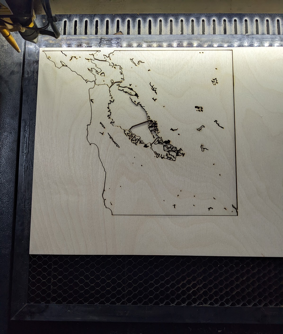
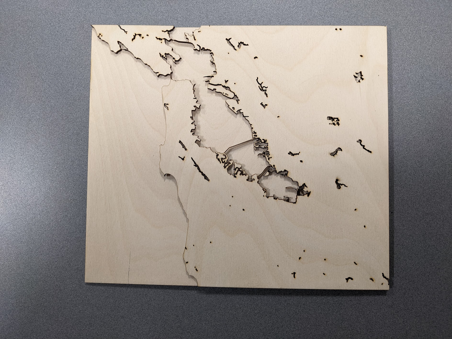
1/29/2023 – The first two layers of my map have been laser cut with little to no issues. The water is a really simple layer so it took almost no time to complete. The land layer took a bit longer because of the detail along the shoreline as well as the cuts needed for smaller lakes and rivers. When trying to cut out the roads layer, I hit some big issues. The first problem was that it was going to take over an hour of cutting and I did not have enough time left in my reservation to wait for it. The second, larger problem was that many of the roads were too thin, so when they were cut out they either burned with the vector cut or they broke off after I had stopped the cuts. Because of this, I have decided to adjust my design to only include more major roads and highways instead of every road in the area. This redesign means that I will also have to re-cut my water and land layers to fit the new dimensions of the design. My new design will look very similar, if not the same, as my old one other than the roads. I am also planning on painting the final design once it has been cut, which I did not do for my first cuts because they would not be ending up on the final design and I did not want to waste resources.
A question that I had about my work is would including some kind of compass image in the water layer to the left of the land make my piece look too busy or would it improve the piece? This would be done through a raster engrave and would probably be relatively simple.
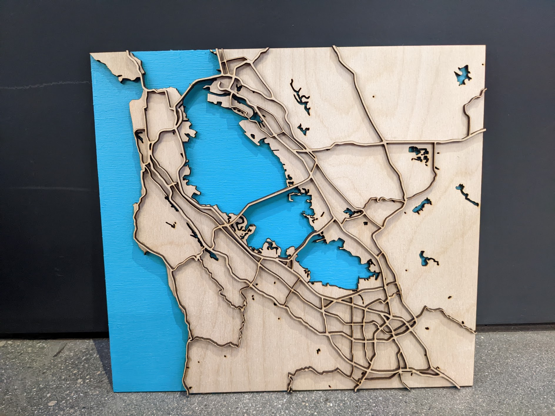
2/01/23 – I changed my design quite a bit from the original to combat some aesthetic and technical issues. The first thing I did was to zoom in a bit more to make sure the roads+landscape were a bit larger and more detailed. I did not see a need to include as much of the area that is north of the Golden Gate Bridge because I do not go there often and it technically doesn’t count as part of the Bay Area. The other major thing I did was only include major roads and highways. I also included bridges, but I counted those as major roads. Overall, I really like how my design turned out, but I think I would use different settings on the laser cutter next time to make sure all of my cuts went all the way through.
The blue in the photo is a lot brighter than the blue in real life. In person, it is a bit more green and dark to match the water color of the bay and Pacific Ocean.
I think adding the compass would improve the piece! I think it would look cool. I have a suggestion for the water layer, maybe try using blue acrylic!
I think the compass would definitely improve the piece and wouldn’t make it look busy because there’s still plenty of empty space to work with. I was also struck by the delicacy of the bridges which makes them feel more to scale.
i like the idea of the compass, it makes the piece more interesting! plus, it may help orient the viewer. i am not familiar with the area and am having a difficult time distinguishing what is what- i am glad you are planning on painting this, because i think it will help!
I would suggest adding a compass. I am also doing a map for this project that includes 3 compass, and I don’t believe it is too crowded yet. Also, I am amazed at how good the blue paint looks for the water. What type of paint did you use? I might end up painting my map with the same type.