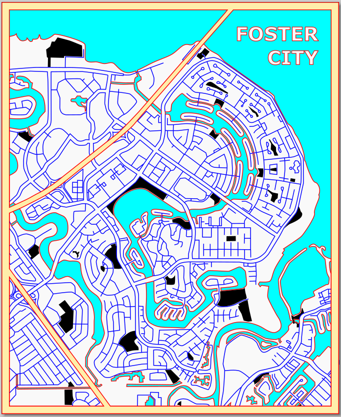
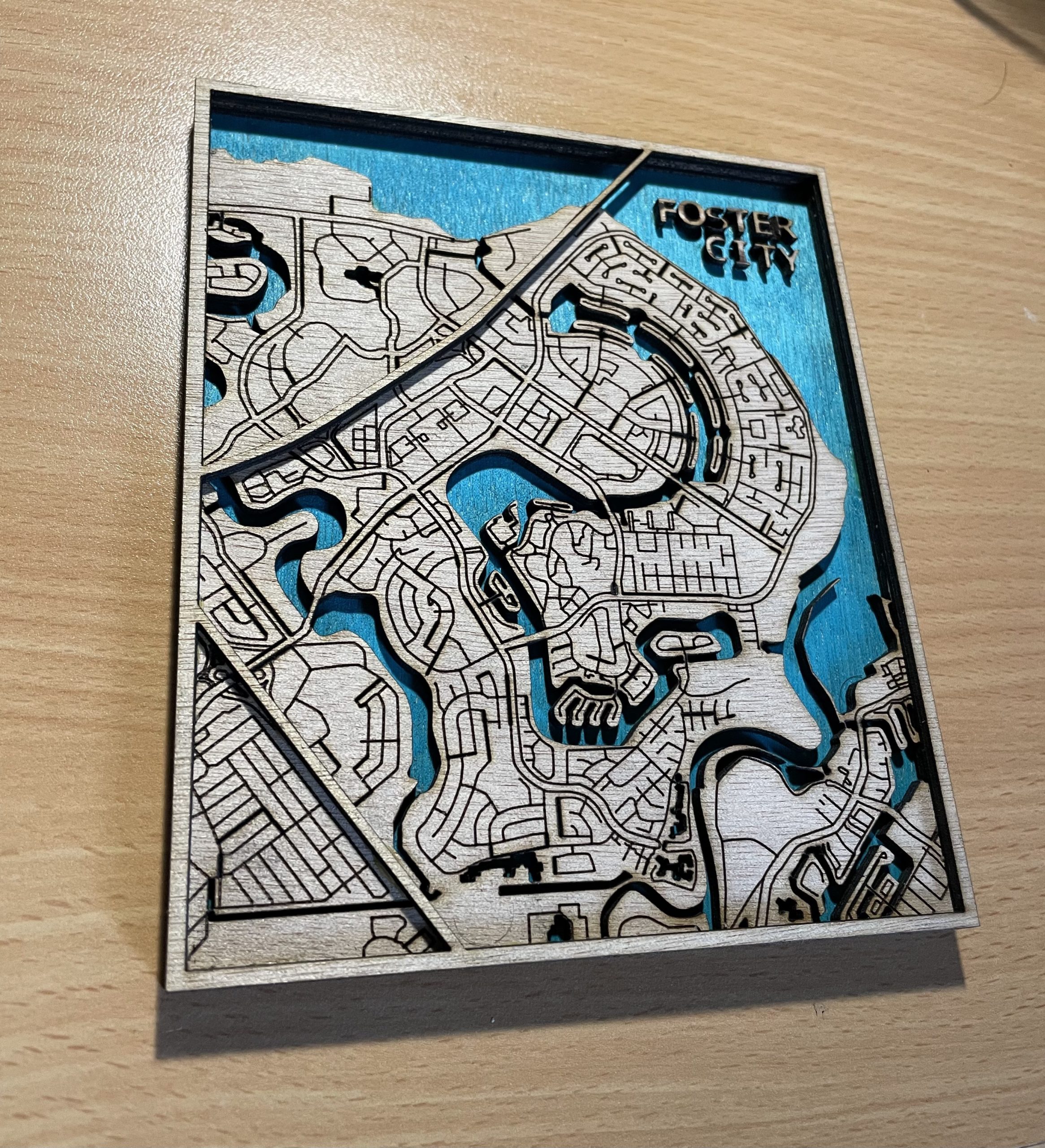
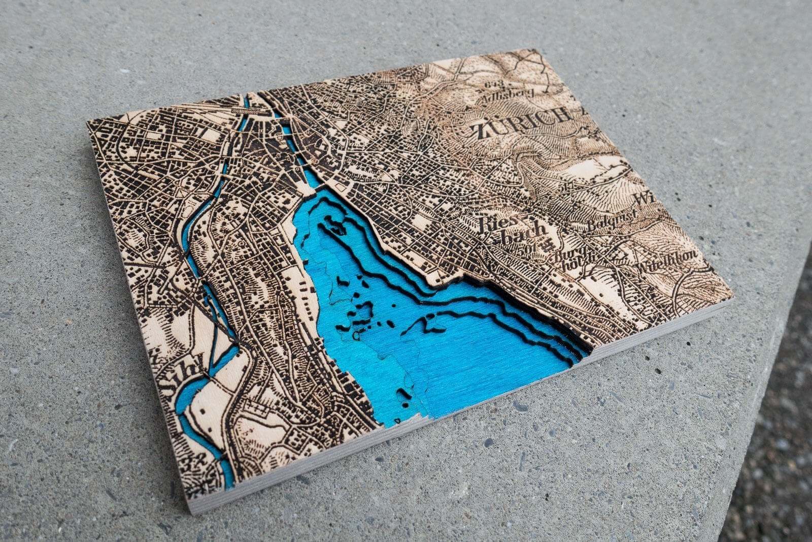
My idea for the layers project is to create a map of my hometown Foster City. This city is built at the shoreline and is very flat so there are no topographical features to show. I took inspiration from a picture of a laser cut map that only uses one very detailed layer for the land. This piece will have 3 layers, light blue, white, and yellow on top. I am considering adding labels on the top layer to mark important landmarks.
Artist Questions:
Should I implement more layers and if so, what parts of this should be separated?
Should I label places of interest or leave it as just a street map?
How should I go about attaching the layers together since some of the pieces are extremely small? I am worried about the glue making a mess if it spreads.
What do you plan to have raster or engraved?
I am planning to raster the parks which are shown in black and vector engrave the roads in blue
What do you plan to label?
I was planning to label important places in town such as parks or stores although I am not sure if I will go through with it
are you planning on using rastering or just multiple layers to create this?
I am planning to have 3 layers in total although the middle layer which has all the roads and parks will be engraved
What’s your plan for combining the different layers together?